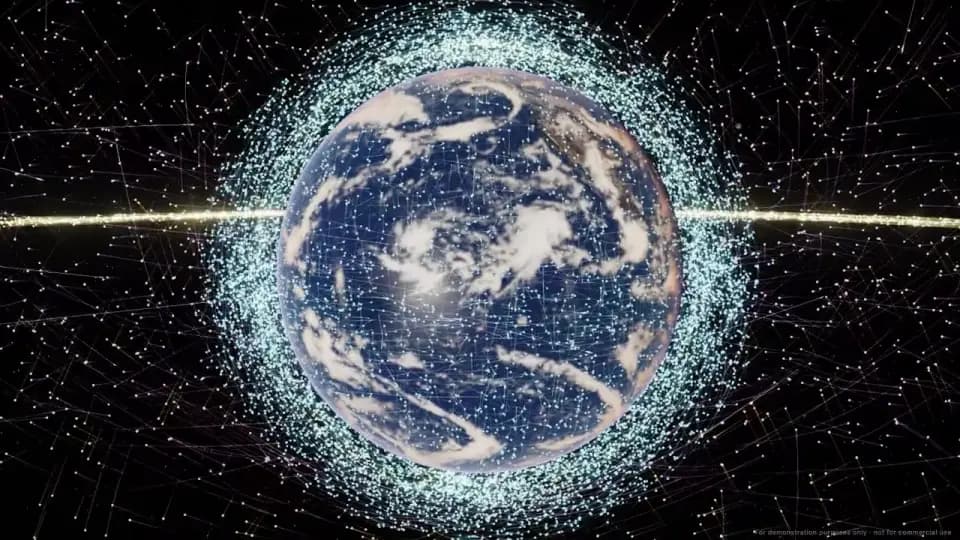
Orbit swarm
Millions of ships on exact Kepler orbits, solved every frame in compute shaders, among 16,500+ real satellites.
Open the globe (Orbit swarm)
In active developmentUpdated
From deep space to underwater reefs, in a browser tab.
Millions of starships and 16,500+ real satellites around an Earth built from open data. It runs on a custom renderer written directly on WebGPU, with a WebGL2 fallback, rather than on Unity or any other game engine. Nothing to install.
Runs in a browser with WebGPU or WebGL2. Phones get touch controls and a lighter, adaptive render tier; a desktop GPU still shows the most detail.
8M
starships on exact orbits, held above 24 fps
16,500+
real satellites, placed where they are now
80×
more ships on the GPU than on one CPU core
33
landmarks built from published dimensions
100%
open data, from NASA and NOAA to OpenStreetMap
0
game engines or rendering libraries
Ship counts from the built-in CPU vs GPU showdown, measured on an Apple M1 Max in Chrome.
With sound and on-screen captions. Every shot is the app running, captured frame by frame.
Planet DOTS trailer: Earth in its swarm of satellites, a dive through the clouds into the Alps and the Matterhorn, Europe from day to night, a montage of landmarks from Paris, San Francisco and New York to Rio, Sydney, Rome, Giza, Dubai and Machu Picchu, Central Park through the seasons, a dive into a coral reef in the Maldives, and a pull back into deep space to the black hole M87*.
Each card opens the app right there.
Open a place on your phone or desktop. The next view starts loading while you fly there.
Millions of ships on exact Kepler orbits, solved every frame in compute shaders, among 16,500+ real satellites.
Open the globe (Orbit swarm)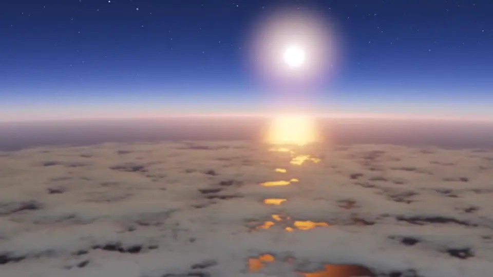
Volumetric clouds from the NOAA GFS forecast and satellite cloud maps.
Open this view (Real weather)
Streamed terrain and aerial imagery, with 3D buildings from OpenStreetMap.
Open this view (Cities in 3D)
33 of them, from the Golden Gate Bridge to the pyramids of Giza, rebuilt from published measurements.
Open this view (Landmarks)
Snow, autumn colour and bare trees follow the date. Change it in the time bar to watch the park turn.
Open Central Park in autumn (Seasons)
NASA Black Marble city lights, lit by the real Moon's position and phase.
Open this view (Night side)
Dive to real sea-floor depth: 3D coral where the data says reef, with fish at their real sizes.
Open this view (Underwater reefs)
Black holes and galaxies at their real positions, with light bent by gravity.
Fly to M87* (Deep space)Most ships above 24 fps · Apple M1 Max, Chrome
The same orbit math on one CPU core, on every core in Rust SIMD, then on the GPU.
Launch, then press ⚡ CPU vs GPU (CPU vs GPU)Every feature, the architecture, the stack and measured performance
01
Open data
Orbits, weather, waves and tides ship with the build; terrain, imagery and buildings stream as tiles.
02
Web Workers
Decode and mesh off the main thread: vector tiles, 3D Tiles + Draco, Rust → WASM SIMD.
03
GPU compute
WGSL kernels solve every orbit each frame, cull, and write indirect draw lists.
04
Rendering
HDR, a physically based sky, FFT ocean and volumetric clouds. WebGL2 as the fallback.
| Path | Ships |
|---|---|
| JavaScript, one core | 100,000 |
| Rust → WASM SIMD, 5 workers | 4,000,000 (its cap) |
| WebGPU compute | 8,000,000 |
Most ships held above 24 fps, Apple M1 Max in Chrome. The app runs the same race on your machine.
Latest update:
Smoother flights
Flights between Explore places ease in and out, and the light shifts gradually on the way instead of jumping at take-off.
Flights on phones
Flights play by default on every device. If a phone measurably struggles, a one-time prompt offers a fade to black instead.
A better phone view
Sharper presentation and adaptive detail keep the scene readable as the camera moves and settles.
Places load on the way
Explore starts fetching the next destination during the flight, then brings in imagery and buildings as they arrive.
Reefs on slower links
Nearby reef tiles get priority during a phone arrival; temporary tile failures are retried.
Phone controls
One menu, larger touch targets and a clear way back make it easier to explore in an in-app browser.
Follow a satellite
The camera stays aligned with the satellite's rendered orbit, and real satellites draw their detailed 3D models in every browser, phones included.
From first paint
A loading state appears before the globe's first frame and clears when the scene is ready.
A living world
More wildlife and weather that changes over time. In development.
Further out: More of the Solar System, up close · Phones to high-end desktops, tuned for each.
Plans, not promises: the order may change.
Frame rate, ship counts and GPU timings in the app are measured live, on your hardware.
Launch Planet DOTSI'm Scott Robertson. Planet DOTS is my own project, a web-native remake of my original Unity DOTS Planet demo. I've spent 18+ years in real-time 3D, XR and autonomy, including five at Lockheed Martin Skunk Works.
NASA · NOAA · CelesTrak · ADSB.lol · Copernicus · EOX · GEBCO · Open Waters · DGFI-TUM · ESO · Event Horizon Telescope · Pan-STARRS · Solar System Scope · OpenStreetMap · Mapterhorn · OpenFreeMap · swisstopo · IGN · PNOA · PDOK · GSI Japan · NSW Spatial Services · USGS
Full attributions and licences are in the app's About panel. The privacy page lists the services its map layers contact.